Book Tickets Online
About
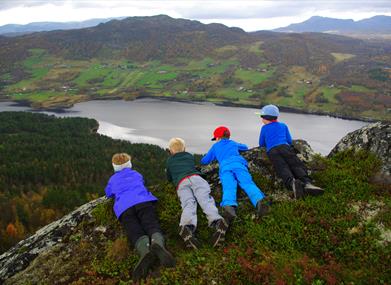
From the fjord to the moutains.
Nice hike along the south side of Vatsfjorden, along water and through birch forest. From the top you get panoramic view towards Reineskarvet and Lauvdalsbrea.
For map and elevation profile of this hike see www.aal52.no
How to get here: From State Highway 7, follow district road Fv. 244 to Vats (about 17 km from the center of Ål).
Park at the eastern part of Vatsfjorden
Facilities
Distance
- length in km - 4 t / r
Grading
- easy - Blå, blue, blau
Nature and terrain
- difference in altitude - 740 - 980
- hiking area
- mountainous terrain
- view
- water