Book Tickets Online
About
Nysetknippen (1150 masl) is a land mark, both from the side of Veståsen and the other side of the valley. The characteristic pyramideshaped and steep front is easily recognisable.
Drive up Vestlia from Ål station to Jonsetsvingen. Toll road (cash only). Then you follow Nysetvegen past Randitjørni and old Nyset until you see the old mountain farms by Nyset. Park on the left side of the road. You can now see the "back side" of Nysetknippen.
Start the hike by walking the trail towards Hustjørni and Presttjørni for a while until the trail divides. Here you will find a sign to Nysetknippen and you will take to the right.
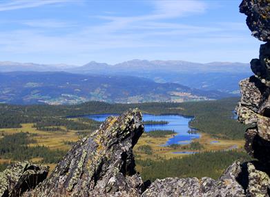
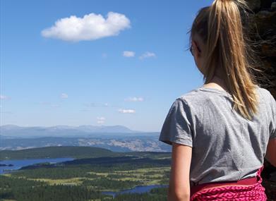
Follow the trail upwards until you pass the tree line. You will now follow the mountain ridge to the top and get an excellent view. The area underneath Nysetknippen is quite flat with many idyllic fishing waters. On the top just by the edge you find a large cairn.
Facilities
Distance
- length in km - 3
Duration
- 1 hour
Grading
- easy - Blå/blue/blau
Nature and terrain
- difference in altitude - 1070-1150
- forest area
- mountainous terrain
- view
Season
- Autumn
- Spring
- Summer